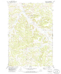
1979 Map of Corey Flat
USGS Topo · Published 1986About this map
The high plateau of Corey Flat dominates this 1970s Musselshell County landscape, revealing an era of intense resource extraction and rural land management. The terrain is defined by the drainage basins of Fishel Creek and Hawk Creek, where numerous water and industrial points are documented. Insights into the region's energy development are evident through the distribution of several Well sites, a Flowing Well, and specific industrial locations like the Mines and the Page Well. Near Tripod Hill, the map shows a network of springs and unpaved roads, illustrating how land use in this part of Montana was dictated by the availability of water and the requirements of subsurface exploration.
Find a feature on this map
11 named features on this map. Tap any name to fly to it.
Don’t see what you’re looking for? This feature index may not catch every label — zoom into the map to look around manually.
Map Details
Editions of this 1979 Corey Flat Map
2 editions found

Other maps of this area

1954 · Forsyth
USGS Topo · 1:250,000

1954 · Roundup
USGS Topo · 1:250,000

1957 · Forsyth
USGS Topo · 1:250,000

1958 · Roundup
USGS Topo · 1:250,000

1958 · Forsyth
USGS Topo · 1:250,000

1962 · Queens Point
USGS Topo · 1:24,000

1963 · Musselshell
USGS Topo · 1:24,000

1963 · Delphia
USGS Topo · 1:24,000

1979 · Roundup
USGS Topo · 1:100,000

1979 · Melstone
USGS Topo · 1:100,000