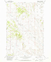
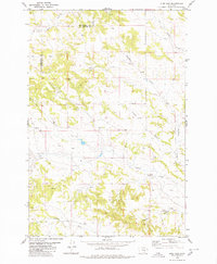
1980 Map of Mailbox Hill
USGS Topo · Published 1980About this map
Mail Box Hill rises as a prominent landmark in this high plains region of Yellowstone County, where the landscape is defined by the drainage systems of Buffalo Creek and East Buffalo Creek. Based on aerial photography from 1973, this survey illustrates a transition toward more intensive land use, particularly in the northern sections where a Landing Strip and numerous Flowing Wells appear. The distribution of Drill Holes and Wells across the terrain suggests an era of active subsurface exploration, likely for water or energy resources, while Spring sites and Coulees indicate the vital natural water points that have long sustained this semi-arid environment. These specific industrial and natural features provide a clear record of the area's development before the late 20th century.
Find a feature on this map
10 named features on this map. Tap any name to fly to it.
Don’t see what you’re looking for? This feature index may not catch every label — zoom into the map to look around manually.
Map Details
Editions of this 1980 Mailbox Hill Map
This is the sole edition of this map. No revisions or reprints were ever made.
Other maps of this area

1954 · Forsyth
USGS Topo · 1:250,000

1957 · Forsyth
USGS Topo · 1:250,000

1958 · Forsyth
USGS Topo · 1:250,000

1960 · Coal Bank Creek
USGS Topo · 1:24,000

1979 · Hysham
USGS Topo · 1:100,000

1980 · Mud Butte
USGS Topo · 1:24,000
1980 · Bull Mountain NW
USGS Topo · 1:24,000
1980 · Weed Creek West
USGS Topo · 1:24,000
1980 · Weed Creek East
USGS Topo · 1:24,000
1980 · Pine View
USGS Topo · 1:24,000