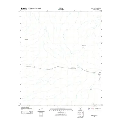
2011 Map of Maish Vaya
USGS Topo · Published 2011About this map
Maish Vaya and the surrounding desert landscape of the Gu Achi District are defined by a complex network of seasonal drainages, most notably the Santa Rosa Wash, which flows north toward Brownell Valley. The 2011 survey captures several small settlements along the base of the Brownell Mountains and Sierra Blanca, including Stoa Vaya and Narcho Santos. A significant transportation corridor traverses the center of the sheet at Quijotoa Pass, where the road meets Quijotoa Wash. Historically significant landmarks like Covered Wells and the settlement of Quijotoa occupy the southeastern reaches of the map, connected by Indian Rte 133. The arrangement of these small outposts near mountain gaps and major washes reflects the traditional settlement patterns where water access and topographic passage dictated the location of community life in Pima County.
Find a feature on this map
14 named features on this map. Tap any name to fly to it.
Don’t see what you’re looking for? This feature index may not catch every label — zoom into the map to look around manually.
Map Details
Editions of this 2011 Maish Vaya Map
This is the sole edition of this map. No revisions or reprints were ever made.
Other maps of this area

1953 · Ajo
USGS Topo · 1:250,000

1957 · Ajo
USGS Topo · 1:250,000

1958 · Ajo
USGS Topo · 1:250,000

1962 · Ajo
USGS Topo · 1:250,000

1963 · Ajo
USGS Topo · 1:250,000

1963 · Gu Achi
USGS Topo · 1:62,500

1963 · Quijotoa Mts
USGS Topo · 1:62,500

1963 · Cimarron Peak
USGS Topo · 1:62,500

1963 · Pisinimo
USGS Topo · 1:62,500

1967 · Ajo
USGS Topo · 1:250,000
Featured Places
- Maish Vaya, Gu Achi District
- Pisinemo District, AZ
- Gu Achi District, AZ
- Sells, AZ
- Narcho Santos, Gu Achi District