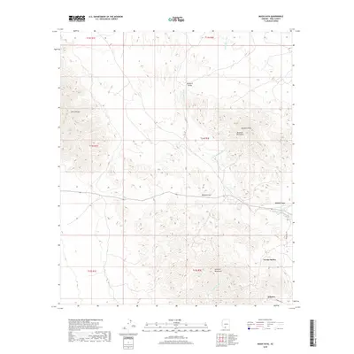
2018 Map of Maish Vaya
USGS Topo · Published 2018About this map
The Brownell Mountains and the northern reaches of the Quijotoa Mountains define the high ground of this Sonoran Desert landscape in Pima County. At the heart of the region, the Quijotoa Pass serves as a critical transit point through the uplifted terrain, while the settlement of Maish Vaya and the community of Narcho Santos occupy the lower reaches near the drainage systems. The map illustrates a landscape shaped by seasonal water flow, with the Santa Rosa Wash, Quijotoa Wash, and Pisinimo Wash carving paths through the Brownell Valley. Local infrastructure is concentrated along Indian Rte 32 and Indian Rte 132, which connect the isolated settlements. Toward the south, the village of Quijotoa marks an area of established human presence amidst the peaks of Sierra Blanca and Brownell Peak.
Find a feature on this map
20 named features on this map. Tap any name to fly to it.
Don’t see what you’re looking for? This feature index may not catch every label — zoom into the map to look around manually.
Map Details
Editions of this 2018 Maish Vaya Map
This is the sole edition of this map. No revisions or reprints were ever made.
Other maps of this area

1953 · Ajo
USGS Topo · 1:250,000

1957 · Ajo
USGS Topo · 1:250,000

1958 · Ajo
USGS Topo · 1:250,000

1962 · Ajo
USGS Topo · 1:250,000

1963 · Ajo
USGS Topo · 1:250,000

1963 · Gu Achi
USGS Topo · 1:62,500

1963 · Quijotoa Mts
USGS Topo · 1:62,500

1963 · Cimarron Peak
USGS Topo · 1:62,500

1963 · Pisinimo
USGS Topo · 1:62,500

1967 · Ajo
USGS Topo · 1:250,000
Featured Places
- Maish Vaya, Gu Achi District
- Pisinemo District, AZ
- Gu Achi District, AZ
- Sells, AZ
- Narcho Santos, Gu Achi District