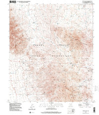
1996 Map of Maish Vaya
USGS Topo · Published 2001About this map
Tohono O'odham Indian Reservation lands dominate this arid high-desert landscape in Pima County, where mid-century topography meets late-1990s planimetry. The map centers on the Quijotoa Mountains and Brownell Mountains, a region defined by its long-standing mining activity and small, dispersed settlements. Clusters of industrial features like the Open Pit Mine, Strip Mine, and numerous Mine Shafts near Brownell Peak indicate the intensive mineral extraction that has shaped the local economy.
Find a feature on this map
21 named features on this map. Tap any name to fly to it.
Don’t see what you’re looking for? This feature index may not catch every label — zoom into the map to look around manually.
Map Details
Editions of this 1996 Maish Vaya Map
This is the sole edition of this map. No revisions or reprints were ever made.
Other maps of this area

1953 · Ajo
USGS Topo · 1:250,000

1957 · Ajo
USGS Topo · 1:250,000

1958 · Ajo
USGS Topo · 1:250,000

1962 · Ajo
USGS Topo · 1:250,000

1963 · Ajo
USGS Topo · 1:250,000

1963 · Gu Achi
USGS Topo · 1:62,500

1963 · Quijotoa Mts
USGS Topo · 1:62,500

1963 · Cimarron Peak
USGS Topo · 1:62,500

1963 · Pisinimo
USGS Topo · 1:62,500

1967 · Ajo
USGS Topo · 1:250,000
Featured Places
- Maish Vaya, Gu Achi District
- Narcho Santos, Gu Achi District
- Gu Achi District, AZ
- Quijotoa, Sells
- Sells, AZ