2021 Map of Maitland
USGS Topo · Published 2021About this map
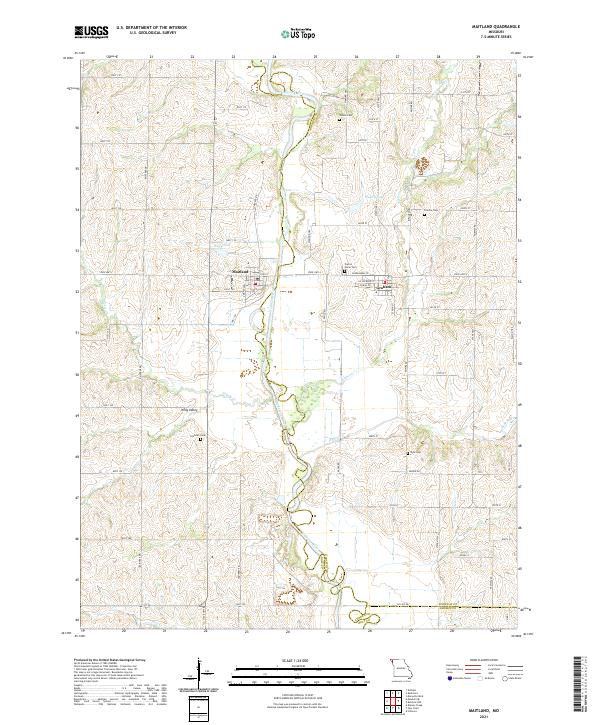
The meandering Nodaway River forms the central spine of this northwestern Missouri landscape, carving a complex path that defines the boundary between Holt and Nodaway Counties. The town of Maitland serves as a local hub west of the river, while Graham is situated to the east. The terrain is characterized by the broad Whig Valley and numerous small tributaries like Highly Creek and Elkhorn Creek. This survey provides significant genealogical value, documenting several local burial grounds including Groves Cemetery, Linville Cemetery, Prairie Home Cemetery, Schooler Cemetery, and Kyle Cemetery. Small bodies of water such as Wakley Lake and Wiley Lake dot the agricultural landscape, which is navigated by a network of rural routes like State Highway ZZ and Elkhorn Trail.
Find a feature on this map
65 named features on this map. Tap any name to fly to it.
Don’t see what you’re looking for? This feature index may not catch every label — zoom into the map to look around manually.
Map Details
Editions of this 2021 Maitland Map
This is the sole edition of this map. No revisions or reprints were ever made.