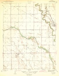
1942 Map of Maize
USGS Topo · Published 1942About this map
The Arkansas River and the Little Arkansas River converge near Valley Center, creating a complex drainage network defined by the Big Slough and Cowskin Creek. Surveyed just before the United States entered World War II, the landscape is a grid of agricultural sections punctuated by small rural schoolhouses like Prairie Queen Sch and Corn Sch, which served the local farming families of the Elgan Valley.
Find a feature on this map
25 named features on this map. Tap any name to fly to it.
Don’t see what you’re looking for? This feature index may not catch every label — zoom into the map to look around manually.
Map Details
Editions of this 1942 Maize Map
2 editions found
Other maps of this area

1889 · Cheney
USGS Topo · 1:125,000

1889 · Wichita
USGS Topo · 1:125,000

1891 · Cheney
USGS Topo · 1:125,000

1894 · Wichita
USGS Topo · 1:125,000

1901 · Cheney
USGS Topo · 1:125,000

1941 · Maize
USGS Topo · 1:31,680

1941 · Valley Center
USGS Topo · 1:31,680

1942 · Valley Center
USGS Topo · 1:31,680

1942 · Maize
USGS Topo · 1:31,680

1943 · Wichita West
USGS Topo · 1:31,680