1942 Map of Maize
USGS Topo · Published 1942About this map
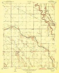
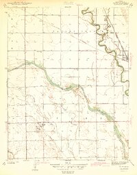
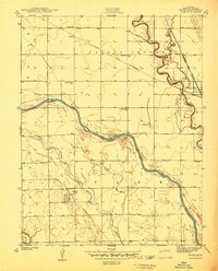
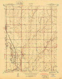
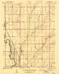
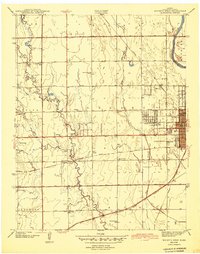
The Little Arkansas River and Big Slough define the hydrologic character of this Sedgwick County landscape as it appeared just before the mid-century. The settlement of Maize serves as a central hub, situated along the Missouri Pacific railroad line and home to the Maize Cem. To the northeast, the town of Valley Center marks a significant rail junction where the St Louis San Francisco and the Atchison Topeka and Santa Fe Electric lines converge. This 1939 survey reflects a rural agricultural economy supported by a dense network of country schools, including Prairie Queen Sch, West Union Sch, and Gem Sch. The proximity of small communities like Coleman and Ferguson to the meandering river and the interlacing rail lines illustrates the transportation-dependent growth patterns of the era.
Find a feature on this map
20 named features on this map. Tap any name to fly to it.
Don’t see what you’re looking for? This feature index may not catch every label — zoom into the map to look around manually.
Map Details
Editions of this 1942 Maize Map
2 editions found
Other maps of this area

1889 · Cheney
USGS Topo · 1:125,000

1889 · Wichita
USGS Topo · 1:125,000

1891 · Cheney
USGS Topo · 1:125,000

1894 · Wichita
USGS Topo · 1:125,000

1901 · Cheney
USGS Topo · 1:125,000
1941 · Maize
USGS Topo · 1:31,680
1941 · Valley Center
USGS Topo · 1:31,680
1942 · Valley Center
USGS Topo · 1:31,680
1943 · Wichita West
USGS Topo · 1:31,680

1943 · Wichita East
USGS Topo · 1:31,680