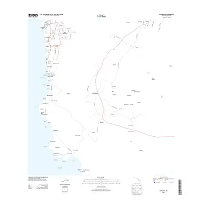
2013 Map of Makena
USGS Topo · Published 2013About this map
Wailea and Mākena anchor the coastline of this 2013 survey, where developed resort and residential areas like Maui Meadows meet the volcanic and agrarian landscape of South Maui. The terrain rises sharply from coastal points like Cape Kina‘u and Pu‘uōla‘i toward the upcountry settlements of ‘Ulupalakua and Keōkea. This shift from the shoreline to the higher elevations is marked by a change in land use, from the fairways of the Mākena Golf Course to the rural infrastructure of the Kula Pipeline.
Find a feature on this map
118 named features on this map. Tap any name to fly to it.
Don’t see what you’re looking for? This feature index may not catch every label — zoom into the map to look around manually.
Map Details
Editions of this 2013 Makena Map
This is the sole edition of this map. No revisions or reprints were ever made.
Other maps of this area

1954 · Maui
USGS Topo · 1:250,000

1954 · Maalaea
USGS Topo · 1:24,000

1954 · Puu O Kali
USGS Topo · 1:24,000

1954 · Makena
USGS Topo · 1:24,000

1957 · Kilohana
USGS Topo · 1:24,000

1957 · Lualailua Hills
USGS Topo · 1:24,000

1966 · Maui
USGS Topo · 1:250,000

1974 · Maui
USGS Topo · 1:250,000
1983 · Lualailua Hills
USGS Topo · 1:24,000
1983 · Maalaea
USGS Topo · 1:24,000