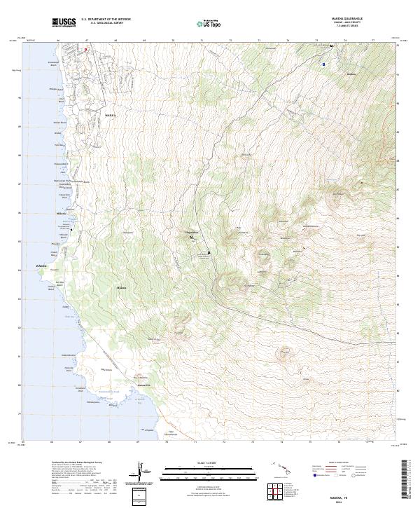
2024 Map of Makena
USGS Topo · Published 2024About this map
Mākena and the leeward slopes of Maui define this coastal landscape, stretching from the developed resorts of Wailea south to the volcanic remnants at Cape Kina'u. The map reveals a transition from modern coastal infrastructure along S Kihei Rd and Wailea Alanui Dr to the more rural, high-elevation settlements like 'Ulupalakua and Keokea. Genealogists will find several notable burial grounds, including the Keawala'i Congregational Church Cem near Keawala'i Makena Bay and the Saint James the Lesser Catholic Church Cem perched higher on the mountain side. The southern reaches are dominated by volcanic features such as Pu'uōla'i and Kalua o Lapa, leading to the remote shoreline of La Perouse Bay. This documentation provides a clear view of how residential growth around Keawakapu Beach and Ulua Beach meets the preserved cultural and natural landmarks of the southern coast.
Find a feature on this map
106 named features on this map. Tap any name to fly to it.
Don’t see what you’re looking for? This feature index may not catch every label — zoom into the map to look around manually.
Map Details
Editions of this 2024 Makena Map
This is the sole edition of this map. No revisions or reprints were ever made.
Other maps of this area

1954 · Maui
USGS Topo · 1:250,000

1954 · Maalaea
USGS Topo · 1:24,000

1954 · Puu O Kali
USGS Topo · 1:24,000

1954 · Makena
USGS Topo · 1:24,000

1957 · Kilohana
USGS Topo · 1:24,000

1957 · Lualailua Hills
USGS Topo · 1:24,000

1966 · Maui
USGS Topo · 1:250,000

1974 · Maui
USGS Topo · 1:250,000
1983 · Lualailua Hills
USGS Topo · 1:24,000
1983 · Maalaea
USGS Topo · 1:24,000