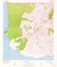
1954 Map of Makena
USGS Topo · Published 1972About this map
The south shore of Maui in the mid-1950s is defined by a sparse coastline and the rising slopes of Haleakalā, where life centers on ranching and isolated homesteads. Ulupalakua Ranch serves as a primary hub of activity, supporting the Ulupalakua School and anchoring the regional postal network. Along the coast, Makena and the Keawalai Church represent the early coastal settlements before the modern resort era, while the Keawakapu label marks a location of former habitation. The landscape is dotted with volcanic features like the prominent Puu Olai and complex lava flows around Cape Kinau. On the higher elevations, institutions such as the Kula Sanatorium and the Maui County Farm indicate a shift in land use toward healthcare and agriculture, while the Kanaio Prison Camp provides a specific historical marker of the island's mid-century correctional history.
Find a feature on this map
87 named features on this map. Tap any name to fly to it.
Don’t see what you’re looking for? This feature index may not catch every label — zoom into the map to look around manually.
Map Details
Editions of this 1954 Makena Map
3 editions found
Other maps of this area

1954 · Maui
USGS Topo · 1:250,000

1954 · Maalaea
USGS Topo · 1:24,000

1954 · Puu O Kali
USGS Topo · 1:24,000

1954 · Makena
USGS Topo · 1:24,000

1957 · Kilohana
USGS Topo · 1:24,000

1957 · Lualailua Hills
USGS Topo · 1:24,000

1966 · Maui
USGS Topo · 1:250,000

1974 · Maui
USGS Topo · 1:250,000
1983 · Lualailua Hills
USGS Topo · 1:24,000
1983 · Maalaea
USGS Topo · 1:24,000