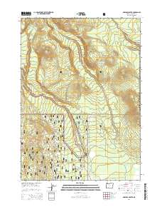
2014 Map of Maklaks Crater
USGS Topo · Published 2014About this map
Crater Lake National Park and the Winema National Forest dominate this landscape, highlighting a region defined by dramatic volcanic topography. The terrain is marked by prominent elevations such as Crater Peak, Vidae Ridge, and Grayback Ridge, while the central feature, Maklaks Crater, stands near Maklaks Pass. This survey illustrates the intricate drainage patterns of the high Cascades, where Annie Cr, Sun Cr, and Sand Cr carve deep into the volcanic soil. Unique geological formations like The Pinnacles and Pinnacle Valley are visible in the northeast, alongside natural landmarks such as Annie Falls and Maklaks Spring. The map documents the established transit corridors including the Crater Lake Hwy and Grayback Rd, providing a clear record of forest access roads and national park boundaries during the early twenty-first century.
Find a feature on this map
26 named features on this map. Tap any name to fly to it.
Don’t see what you’re looking for? This feature index may not catch every label — zoom into the map to look around manually.
Map Details
Editions of this 2014 Maklaks Crater Map
This is the sole edition of this map. No revisions or reprints were ever made.
Other maps of this area

1889 · Klamath
USGS Topo · 1:250,000

1891 · Ashland
USGS Topo · 1:250,000

1893 · Ashland
USGS Topo · 1:250,000

1894 · Klamath
USGS Topo · 1:250,000

1897 · Ashland
USGS Topo · 1:250,000

1955 · Pelican Butte
USGS Topo · 1:62,500

1955 · Klamath Falls
USGS Topo · 1:250,000

1955 · Medford
USGS Topo · 1:250,000

1957 · Medford
USGS Topo · 1:250,000

1957 · Chiloquin
USGS Topo · 1:62,500