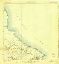
1924 Map of Makuu
USGS Topo · Published 1924About this map
The coastal landscapes of the Puna Dist. and S. Hilo Dist. are defined here by the intersection of volcanic activity and early 20th-century commerce. The Hawaii Consolidated Ry serves as the primary backbone for the region, connecting small stations like Makuu Sta and Twentymile Sta to the coast. This transit network highlights the transition from traditional settlement patterns at Haena and Auwae to the more structured Nanawale Homesteads. Along the easternmost reach of the island, Cape Kumukahi stands near the volcanic features of Kapoho Crater and Green Lake. The map includes specific notations for the boundary of lava flow and geological cracks, providing a detailed look at how the shifting terrain influenced land use, including the National Guard Reservation and ports like Honolulu Landing.
Find a feature on this map
52 named features on this map. Tap any name to fly to it.
Don’t see what you’re looking for? This feature index may not catch every label — zoom into the map to look around manually.
Map Details
Editions of this 1924 Makuu Map
3 editions found
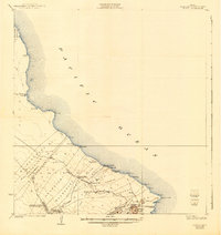
Other maps of this area

1915 · Honomu
USGS Topo · 1:62,500

1917 · Hilo
USGS Topo · 1:62,500

1922 · Puna
USGS Topo · 1:62,500

1924 · Makuu
USGS Topo · 1:62,500

1924 · Puna
USGS Topo · 1:62,500

1924 · Kalapana
USGS Topo · 1:62,500

1932 · Hilo
USGS Topo · 1:62,500

1954 · Hawaii South
USGS Topo · 1:250,000

1954 · Hawaii North
USGS Topo · 1:250,000

1959 · Hawaii South
USGS Topo · 1:250,000