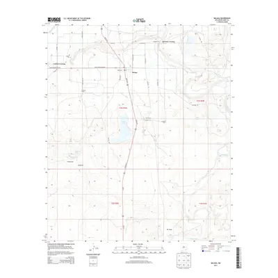
2013 Map of Malaga
USGS Topo · Published 2013About this map
Malaga serves as the central hub of this Chihuahuan Desert landscape, where human settlement is defined by the critical management of water. The Pecos River snakes through the eastern portion of the quadrangle, feeding a complex network of irrigation infrastructure including the Southern Canal, Harroun Ditch, and Willow Cr Ditch. These waterways support several established agricultural outposts such as Plowman Ranch, Reed Ranch, and Cleveland Ranch, which stand in contrast to the arid drainage patterns of China Draw and Salt Draw. Near the historic Lookout Crossing, the Lookout Cem provides a point of genealogical interest for those tracing early families in the Pecos Valley. The presence of Willow Lake, Queen Lake, and Mexican Lake further illustrates the valley's reliance on both natural and engineered water sources for ranching and community survival in Eddy County.
Find a feature on this map
37 named features on this map. Tap any name to fly to it.
Don’t see what you’re looking for? This feature index may not catch every label — zoom into the map to look around manually.
Map Details
Editions of this 2013 Malaga Map
This is the sole edition of this map. No revisions or reprints were ever made.
Other maps of this area

1939 · Carlsbad
USGS Topo · 1:62,500

1939 · Nash Draw
USGS Topo · 1:62,500

1943 · Carlsbad
USGS Topo · 1:62,500

1943 · Nash Draw
USGS Topo · 1:62,500

1945 · Malaga
USGS Topo · 1:62,500

1946 · Malaga
USGS Topo · 1:62,500

1954 · Carlsbad
USGS Topo · 1:250,000

1954 · Hobbs
USGS Topo · 1:250,000

1958 · Carlsbad
USGS Topo · 1:250,000

1958 · Hobbs
USGS Topo · 1:250,000