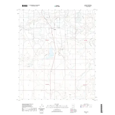
2020 Map of Malaga
USGS Topo · Published 2020About this map
Malaga serves as the central hub of this Chihuahuan Desert landscape, situated near the meandering course of the Pecos River. The settlement's infrastructure is closely tied to its water management systems, including the Harroun Ditch and Willow Cr Ditch, which support the arid surroundings. Local history and genealogy are anchored at the Lookout Cem north of town, while the topography is defined by significant depressions and ephemeral water bodies. Notable landmarks include the sprawling Willow Lake, Mexican Lake, and Horseshoe Lake, alongside deep drainage features like China Draw and Salt Draw. The map details a network of rural roads such as W Ogden Rd and Higby Hole Rd, which connect the scattered agricultural and residential plots across the township and range divisions of Eddy County.
Find a feature on this map
32 named features on this map. Tap any name to fly to it.
Don’t see what you’re looking for? This feature index may not catch every label — zoom into the map to look around manually.
Map Details
Editions of this 2020 Malaga Map
This is the sole edition of this map. No revisions or reprints were ever made.
Other maps of this area

1939 · Carlsbad
USGS Topo · 1:62,500

1939 · Nash Draw
USGS Topo · 1:62,500

1943 · Carlsbad
USGS Topo · 1:62,500

1943 · Nash Draw
USGS Topo · 1:62,500

1945 · Malaga
USGS Topo · 1:62,500

1946 · Malaga
USGS Topo · 1:62,500

1954 · Carlsbad
USGS Topo · 1:250,000

1954 · Hobbs
USGS Topo · 1:250,000

1958 · Carlsbad
USGS Topo · 1:250,000

1958 · Hobbs
USGS Topo · 1:250,000