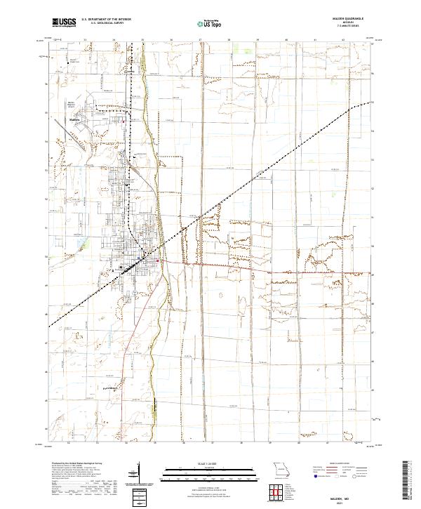
2021 Map of Malden
USGS Topo · Published 2021About this map
Malden Regional Airport and the surrounding agricultural landscape define this portion of the Missouri Bootheel, where a complex network of drainage infrastructure manages the low-lying terrain. The map reveals a heavily engineered environment, characterized by numbered waterways such as Ditch Number 1, Ditch Number 3, and Ditch Number 16 that follow the section lines and road grids. These channels allowed for the intensive farming seen around the smaller communities of Townley and Providence. Genealogical interest is centered on several burial sites scattered across the landscape, including Stevens Chapel Cem in the north and the cluster of Macedonia Cem, Memorial Park Cem, and Rosewood Cem near the main town center. The industrial and transportation character is evident in the street names near the airport, such as Doolittle Pkwy and Spaatz Ave, which reflect the area's aviation history.
Find a feature on this map
94 named features on this map. Tap any name to fly to it.
Don’t see what you’re looking for? This feature index may not catch every label — zoom into the map to look around manually.
Map Details
Editions of this 2021 Malden Map
This is the sole edition of this map. No revisions or reprints were ever made.
Other maps of this area

1940 · Malden
USGS Topo · 1:62,500

1940 · Pascola
USGS Topo · 1:62,500

1940 · Valley Ridge
USGS Topo · 1:62,500

1940 · Piggott
USGS Topo · 1:62,500

1955 · Pascola
USGS Topo · 1:62,500

1956 · Valley Ridge
USGS Topo · 1:62,500

1956 · Piggott
USGS Topo · 1:62,500

1956 · Malden
USGS Topo · 1:62,500

1956 · Dyersburg
USGS Topo · 1:250,000

1957 · Poplar Bluff
USGS Topo · 1:250,000