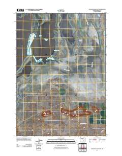
2011 Map of Malheur Lake East
USGS Topo · Published 2011About this map
Malheur Lake and the eastern reaches of the Harney Valley dominate this high-desert basin landscape during the early 21st century. This region of Harney County is defined by its complex hydrology, where the fluctuating shoreline of the lake gives way to landforms like Pelican Island and the meandering Malheur Slough. The intricate network of wetlands and seasonal water bodies reflects the delicate environmental balance characteristic of the Oregon outback.
Find a feature on this map
8 named features on this map. Tap any name to fly to it.
Don’t see what you’re looking for? This feature index may not catch every label — zoom into the map to look around manually.
Map Details
Editions of this 2011 Malheur Lake East Map
This is the sole edition of this map. No revisions or reprints were ever made.
Other maps of this area

1955 · Burns
USGS Topo · 1:250,000

1958 · Burns
USGS Topo · 1:250,000

1959 · Burns
USGS Topo · 1:250,000

1959 · Lawen
USGS Topo · 1:62,500

1960 · Crane
USGS Topo · 1:62,500

1967 · Jackass Butte NE
USGS Topo · 1:24,000

1967 · Barton Lake
USGS Topo · 1:24,000

1967 · Adobe Flat
USGS Topo · 1:24,000

1978 · Malheur Lake
USGS Topo · 1:100,000
1990 · Crane
USGS Topo · 1:24,000