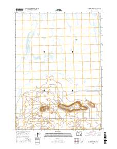
2017 Map of Malheur Lake East
USGS Topo · Published 2017About this map
Malheur Lake dominates the northern reaches of this high desert landscape, characterized by its shifting shorelines and marshy islands like Pelican Island and Cole Island. This 2017 study captures the delicate hydrological balance of the Harney Basin, where the lake's expanse meets the volcanic elevations of the south. Prominent geological markers such as Black Butte and the long, horizontal stretch of Black Butte Ridge provide significant elevation changes against the surrounding flats. The rural infrastructure of this remote area is anchored by several key transportation corridors including Sodhouse Ln and the Narrows-Princeton Rd, which reflect the historic ranching and conservation access routes through this part of the Oregon interior. The map clearly delineates the complex Public Land Survey System boundaries that define land ownership and management across these expansive townships.
Find a feature on this map
14 named features on this map. Tap any name to fly to it.
Don’t see what you’re looking for? This feature index may not catch every label — zoom into the map to look around manually.
Map Details
Editions of this 2017 Malheur Lake East Map
This is the sole edition of this map. No revisions or reprints were ever made.
Other maps of this area

1955 · Burns
USGS Topo · 1:250,000

1958 · Burns
USGS Topo · 1:250,000

1959 · Burns
USGS Topo · 1:250,000

1959 · Lawen
USGS Topo · 1:62,500

1960 · Crane
USGS Topo · 1:62,500

1967 · Jackass Butte NE
USGS Topo · 1:24,000

1967 · Barton Lake
USGS Topo · 1:24,000

1967 · Adobe Flat
USGS Topo · 1:24,000

1978 · Malheur Lake
USGS Topo · 1:100,000
1990 · Crane
USGS Topo · 1:24,000