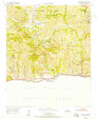
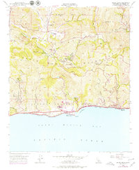
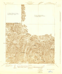
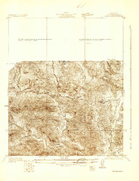
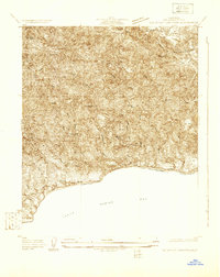
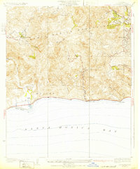
1950 Map of Malibu Beach
USGS Topo · Published 1955About this map
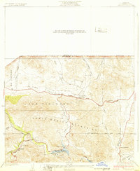
Malibu Beach and the shoreline of Santa Monica Bay meet the steep slopes of the Santa Monica Mountains in this early 1950s survey. The landscape is defined by ranching and private retreats before heavy suburban development, featuring properties like Century Ranch, Brown Ranch, and Stunts Ranch. Inland, the map captures a rural character with landmarks such as the Salvation Army Camp and the now-abandoned Las Virgenes Sch. The Pacific Coast Highway skirts the coast, providing access to Las Flores and Malibu Pt, while the Mulholland Highway winds through the northern canyons. Public spaces and infrastructure are emerging at Tapia Park and the Monte Nido Fire Sta, while the San Bernardino Base Line provides a foundational surveying reference across the northern section of the sheet.
Find a feature on this map
56 named features on this map. Tap any name to fly to it.
Don’t see what you’re looking for? This feature index may not catch every label — zoom into the map to look around manually.
Map Details
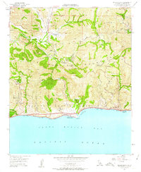
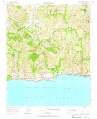
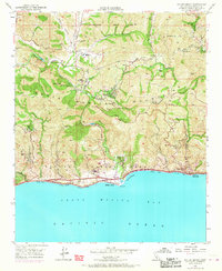
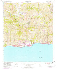
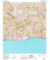
Editions of this 1950 Malibu Beach Map
7 editions found
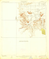
Other maps of this area

1900 · Triunfo Pass
USGS Topo · 1:62,500

1903 · Calabasas
USGS Topo · 1:62,500

1903 · Camulos
USGS Topo · 1:125,000

1921 · Triunfo Pass
USGS Topo · 1:62,500
1928 · Dry Canyon
USGS Topo · 1:24,000
1929 · Dry Canyon
USGS Topo · 1:24,000
1929 · Vejor
USGS Topo · 1:24,000
1929 · Solstice Canyon
USGS Topo · 1:24,000
1932 · Las Flores
USGS Topo · 1:24,000
1932 · Seminole
USGS Topo · 1:24,000
Featured Places
- Calabasas, CA
- Malibu, CA
- Topanga, CA
- Crater Camp, Unincorporated Santa Monica Mountains
- Las Flores, Malibu