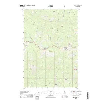
2020 Map of Mallard Peak
USGS Topo · Published 2020About this map
St. Joe National Forest and Clearwater National Forest meet at a high divide in Shoshone and Clearwater Counties, defined by a complex network of ridgelines and alpine basins. The topography centers on the boundary between these two wilderness areas, where Mallard Peak and Heart Peak dominate the skyline. Glacial activity is evident in the numerous high-elevation water bodies, such as Gnat Lake, Crag Lake, and Heart Lake, which feed steep drainage systems like Sawtooth Cr and Cataract Creek.
Find a feature on this map
59 named features on this map. Tap any name to fly to it.
Don’t see what you’re looking for? This feature index may not catch every label — zoom into the map to look around manually.
Map Details
Editions of this 2020 Mallard Peak Map
This is the sole edition of this map. No revisions or reprints were ever made.
Other maps of this area

1911 · Lolo
USGS Topo · 1:250,000

1913 · Lolo
USGS Topo · 1:250,000

1914 · Avery
USGS Topo · 1:125,000

1917 · Avery
USGS Topo · 1:125,000

1918 · St Regis
USGS Topo · 1:125,000

1919 · St. Regis
USGS Topo · 1:125,000

1923 · Washington Creek
USGS Topo · 1:125,000

1956 · Wallace
USGS Topo · 1:250,000

1956 · Hamilton
USGS Topo · 1:250,000

1957 · Simmons Peak
USGS Topo · 1:62,500