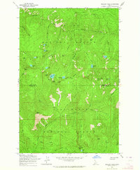
1963 Map of Mallard Peak
USGS Topo · Published 1964About this map
St Joe National Forest and Clearwater National Forest meet along a prominent divide in this 1963 survey of the Idaho panhandle. The landscape is defined by high-altitude fire lookouts and a network of glacial lakes including Heart Lake, Skyland Lake, and the clusters near Larkins Peak. These summits form a dramatic skyline where Sawtooth Ridge and Avalanche Ridge converge. The human footprint is sparse, primarily represented by the Boundary Forest Trail which traces the ridgeline between Shoshone and Clearwater counties. Notable peaks like Mallard Peak and Black Mtn served as critical observation points for forest management during the mid-century. Drainage patterns are established by numerous creeks such as Isabella Creek and Sawtooth Creek, which flow through steep-sided valleys below landmarks like Isabella Point and Wasset Peak.
Find a feature on this map
49 named features on this map. Tap any name to fly to it.
Don’t see what you’re looking for? This feature index may not catch every label — zoom into the map to look around manually.
Map Details
Editions of this 1963 Mallard Peak Map
4 editions found
Other maps of this area

1911 · Lolo
USGS Topo · 1:250,000

1913 · Lolo
USGS Topo · 1:250,000

1914 · Avery
USGS Topo · 1:125,000

1917 · Avery
USGS Topo · 1:125,000

1918 · St Regis
USGS Topo · 1:125,000

1919 · St. Regis
USGS Topo · 1:125,000

1923 · Washington Creek
USGS Topo · 1:125,000

1956 · Wallace
USGS Topo · 1:250,000

1956 · Hamilton
USGS Topo · 1:250,000

1957 · Simmons Peak
USGS Topo · 1:62,500