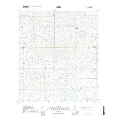
2018 Map of Mallory Swamp SE
USGS Topo · Published 2018About this map
Mallory Swamp dominates this landscape along the border of Lafayette and Dixie counties, characterized by an intricate network of wetland basins and logging grades. In the southeastern corner, the Pleasant Grove Cem stands as a focal point for local genealogy, situated near numerous water bodies like Matthis Lake and Cemetery Lake. The terrain is a complex of hydrologic features, including named depressions and ponds such as Board Pile Bay, Lord Lake, and Hammock Lake. These features, along with Tomlinson Prairie and Desenters Hammock, illustrate the traditional land use patterns of the Florida Big Bend, where timber extraction and small-scale agriculture have historically contended with the seasonal inundation of the karst landscape. Access is defined by a grid of named forest roads and grades, including La'Bennet Grade and Capps Tower Rd, which trace the history of the region's turpentine and lumber industries.
Find a feature on this map
65 named features on this map. Tap any name to fly to it.
Don’t see what you’re looking for? This feature index may not catch every label — zoom into the map to look around manually.
Map Details
Editions of this 2018 Mallory Swamp SE Map
This is the sole edition of this map. No revisions or reprints were ever made.
Other maps of this area

1954 · Mallory Swamp NW
USGS Topo · 1:24,000

1954 · Cross City West
USGS Topo · 1:24,000

1954 · Cross City East
USGS Topo · 1:24,000

1954 · Mallory Swamp SW
USGS Topo · 1:24,000

1954 · Mallory Swamp SE
USGS Topo · 1:24,000

1954 · Mallory Swamp NE
USGS Topo · 1:24,000

1954 · Gainesville
USGS Topo · 1:250,000
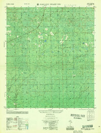
1956 · Mallory Swamp NW
USGS Topo · 1:25,000

1956 · Mallory Swamp SE
USGS Topo · 1:25,000

1958 · Gainesville
USGS Topo · 1:250,000