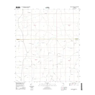
2015 Map of Mallory Swamp SW
USGS Topo · Published 2015About this map
Eightmile Creek and Wolf Creek define the low-lying drainage patterns of this corner of the Big Bend region, where the boundary between Lafayette and Dixie counties meets. The landscape is characterized by its namesake swampy terrain, punctuated by slight rises in elevation such as Knife Hammock and Buck Island. This 2015 survey reveals an extensive grid of modern timber and agricultural access roads, including Cr-357, NW 849th Loop, and NW 953rd Ave, which crisscross the township sections. These paths trace the ongoing management of the Florida pine flatwoods and cypress strands, providing a precise record of rural infrastructure in a sparsely populated but active forestry corridor. The map effectively captures the intersection of public boundaries and private land use within the Florida coastal plain.
Find a feature on this map
75 named features on this map. Tap any name to fly to it.
Don’t see what you’re looking for? This feature index may not catch every label — zoom into the map to look around manually.
Map Details
Editions of this 2015 Mallory Swamp SW Map
This is the sole edition of this map. No revisions or reprints were ever made.
Other maps of this area

1954 · Mallory Swamp NW
USGS Topo · 1:24,000

1954 · Cross City West
USGS Topo · 1:24,000

1954 · Clara
USGS Topo · 1:24,000

1954 · Cross City East
USGS Topo · 1:24,000

1954 · Mallory Swamp SW
USGS Topo · 1:24,000

1954 · Jena
USGS Topo · 1:24,000

1954 · Cooks Hammock
USGS Topo · 1:24,000

1954 · Mallory Swamp SE
USGS Topo · 1:24,000

1954 · Mallory Swamp NE
USGS Topo · 1:24,000

1954 · Gainesville
USGS Topo · 1:250,000