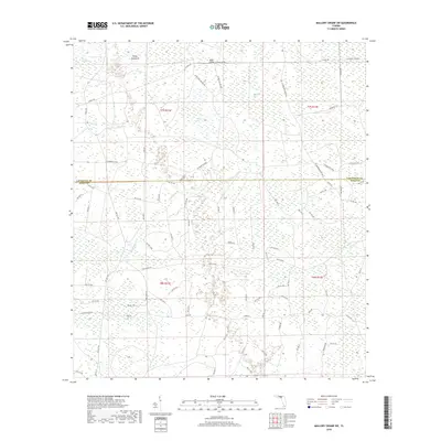
2018 Map of Mallory Swamp SW
USGS Topo · Published 2018About this map
Knife Hammock and Buck Island rise above the complex wetland landscape where the borders of Lafayette and Dixie Counties meet. This 2018 survey documents a remote Florida wilderness defined by extensive swamp systems and a geometric grid of logging and access roads. Large-scale hydrological features such as Mud Swamp, Rayhide Sog, and Tooles Bay dominate the terrain, connected by the drainage of Eightmile Cr and Wolf Cr. The human footprint is visible through an intricate network of named timber and fire grades, including SE Roberts Grade, S Canal Rd, and SE Painters Branch Rd. These routes, along with Hines Hwy, represent the primary infrastructure in a region where natural drainage patterns and commercial forestry dictate the layout of the land.
Find a feature on this map
77 named features on this map. Tap any name to fly to it.
Don’t see what you’re looking for? This feature index may not catch every label — zoom into the map to look around manually.
Map Details
Editions of this 2018 Mallory Swamp SW Map
This is the sole edition of this map. No revisions or reprints were ever made.
Other maps of this area

1954 · Mallory Swamp NW
USGS Topo · 1:24,000

1954 · Cross City West
USGS Topo · 1:24,000

1954 · Clara
USGS Topo · 1:24,000

1954 · Cross City East
USGS Topo · 1:24,000

1954 · Mallory Swamp SW
USGS Topo · 1:24,000

1954 · Jena
USGS Topo · 1:24,000

1954 · Cooks Hammock
USGS Topo · 1:24,000

1954 · Mallory Swamp SE
USGS Topo · 1:24,000

1954 · Mallory Swamp NE
USGS Topo · 1:24,000

1954 · Gainesville
USGS Topo · 1:250,000