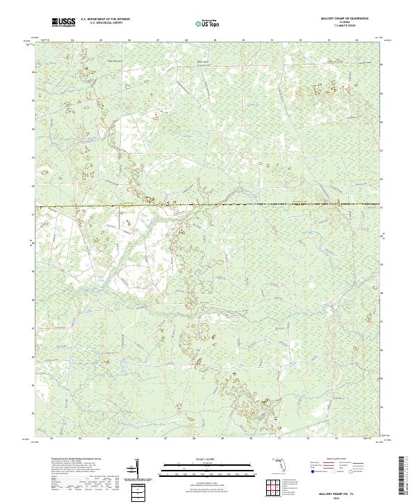
2024 Map of Mallory Swamp SW
USGS Topo · Published 2024About this map
Mud Swamp and the headwaters of Wolf Creek dominate this landscape along the boundary of Lafayette and Dixie Counties. The terrain is characterized by complex wetland systems and distinct topographical rises such as Knife Hammock and Buck Island. This 2024 survey reveals a highly organized network of rural grades and roads that facilitate access through the heavy timber and marshlands, including the lengthy La Bennet Grade and Se Roberts Grade.
Find a feature on this map
81 named features on this map. Tap any name to fly to it.
Don’t see what you’re looking for? This feature index may not catch every label — zoom into the map to look around manually.
Map Details
Editions of this 2024 Mallory Swamp SW Map
This is the sole edition of this map. No revisions or reprints were ever made.
Other maps of this area

1954 · Mallory Swamp NW
USGS Topo · 1:24,000

1954 · Cross City West
USGS Topo · 1:24,000

1954 · Clara
USGS Topo · 1:24,000

1954 · Cross City East
USGS Topo · 1:24,000

1954 · Mallory Swamp SW
USGS Topo · 1:24,000

1954 · Jena
USGS Topo · 1:24,000

1954 · Cooks Hammock
USGS Topo · 1:24,000

1954 · Mallory Swamp SE
USGS Topo · 1:24,000

1954 · Mallory Swamp NE
USGS Topo · 1:24,000

1954 · Gainesville
USGS Topo · 1:250,000