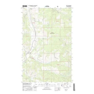
2017 Map of Malo
USGS Topo · Published 2017About this map
Malo and the surrounding highlands of Ferry County are defined by a complex network of drainage basins and mountain roads within the Colville National Forest. The settlement of Malo sits near Saint Peter Flat, where the waters of Curlew Creek and Saint Peter Creek converge. The landscape is deeply carved by water, with the North Fork Saint Peter Creek and South Fork Saint Peter Creek creating distinct valleys that have historically dictated travel and timber access in this corner of the Pacific Northwest. Further north, the small community of Curlew marks the upper reaches of the map near the Tonasket Creek drainage. Notable local landmarks such as Big Lick and Green Spring highlight the natural points of interest that anchor the rural road system, including Aeneas Creek Road and Tonasket Mountain Road.
Find a feature on this map
62 named features on this map. Tap any name to fly to it.
Don’t see what you’re looking for? This feature index may not catch every label — zoom into the map to look around manually.
Map Details
Editions of this 2017 Malo Map
This is the sole edition of this map. No revisions or reprints were ever made.
Other maps of this area

1904 · Republic
USGS Topo · 1:125,000

1936 · Marcus
USGS Topo · 1:96,000

1942 · Marcus
USGS Topo · 1:125,000

1948 · Curlew
USGS Topo · 1:62,500

1948 · Republic
USGS Topo · 1:62,500

1948 · Sherman Peak
USGS Topo · 1:62,500

1948 · Togo Mountain
USGS Topo · 1:62,500

1951 · Togo Mountain
USGS Topo · 1:62,500

1951 · Sherman Peak
USGS Topo · 1:62,500

1951 · Curlew
USGS Topo · 1:62,500