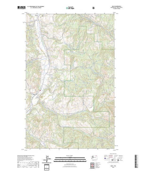
2023 Map of Malo
USGS Topo · Published 2023About this map
Curlew and Malo anchor this portion of Ferry County, situated within the expansive Colville National Forest. The landscape is defined by the drainage systems of Curlew Creek and the intricate forks of Saint Peter Creek, including both the North Fork Saint Peter Creek and South Fork Saint Peter Creek. This contemporary survey illustrates a rural landscape where narrow valley bottoms like Saint Peter Flat host small clusters of habitation while the surrounding uplands remain heavily forested. Genealogical researchers will find the Curlew City Cem positioned just north of the town center. The map also traces various family-named routes and service roads, such as Bjork Ranch Rd and Hillard Ranch, reflecting the enduring legacy of ranching in this corner of Washington. Higher elevations are accessible via routes like the Big Lick Trl near Green Spring, highlighting the intersection of public forest land and local resource management.
Find a feature on this map
54 named features on this map. Tap any name to fly to it.
Don’t see what you’re looking for? This feature index may not catch every label — zoom into the map to look around manually.
Map Details
Editions of this 2023 Malo Map
This is the sole edition of this map. No revisions or reprints were ever made.
Other maps of this area

1904 · Republic
USGS Topo · 1:125,000

1936 · Marcus
USGS Topo · 1:96,000

1942 · Marcus
USGS Topo · 1:125,000

1948 · Curlew
USGS Topo · 1:62,500

1948 · Republic
USGS Topo · 1:62,500

1948 · Sherman Peak
USGS Topo · 1:62,500

1948 · Togo Mountain
USGS Topo · 1:62,500

1951 · Togo Mountain
USGS Topo · 1:62,500

1951 · Sherman Peak
USGS Topo · 1:62,500

1951 · Curlew
USGS Topo · 1:62,500