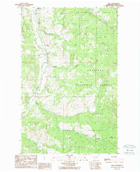
1988 Map of Malo
USGS Topo · Published 1988About this map
The settlement of Malo serves as a small hub within the sprawling evergreen landscape of the Colville National Forest during the late 1980s. This region of northeastern Washington is defined by its deep drainages and active resource extraction, as evidenced by a scattered industrial footprint of a Quarry, Gravel Pit, and a specific Mineshaft. The terrain is segmented by numerous watercourses including Tonasket Creek and St Peter Creek, which flow through the high-elevation topography toward Curlew Flat. Local history is anchored by a marked Cem cemetery near the northern boundary, while the southern reaches are drained by the North Fork and South Fork as they feed into Lambert Creek. The map reflects a landscape primarily dedicated to timber management and mining, with early photography from 1983 capturing the network of forest roads used to navigate the varied peaks.
Find a feature on this map
20 named features on this map. Tap any name to fly to it.
Don’t see what you’re looking for? This feature index may not catch every label — zoom into the map to look around manually.
Map Details
Editions of this 1988 Malo Map
This is the sole edition of this map. No revisions or reprints were ever made.
Other maps of this area

1904 · Republic
USGS Topo · 1:125,000

1936 · Marcus
USGS Topo · 1:96,000

1942 · Marcus
USGS Topo · 1:125,000

1948 · Curlew
USGS Topo · 1:62,500

1948 · Republic
USGS Topo · 1:62,500

1948 · Sherman Peak
USGS Topo · 1:62,500

1948 · Togo Mountain
USGS Topo · 1:62,500

1951 · Togo Mountain
USGS Topo · 1:62,500

1951 · Sherman Peak
USGS Topo · 1:62,500

1951 · Curlew
USGS Topo · 1:62,500