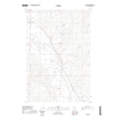
2020 Map of Malone
USGS Topo · Published 2020About this map
The Chehalis River defines the geography of this corridor in Grays Harbor County, where its winding path creates a broad alluvial valley between heavily forested uplands. The settlements of Malone and Porter serve as central points along the valley floor, connected by a network of logging roads and spurs that penetrate the surrounding hills. This modern survey reflects the enduring pattern of valley-floor agriculture and upland timber management that has shaped the region for generations. Near the center of the map, Sharon Cem sits on the western edge of the valley near Ford Prairie, offering a specific point of interest for genealogists tracing local families. The map also detail various drainage systems like Mox Chehalis Cr and Porter Cr, which flow into the main river channel, alongside small lakeside environments such as the Sarvinski Lakes in the northwest.
Find a feature on this map
60 named features on this map. Tap any name to fly to it.
Don’t see what you’re looking for? This feature index may not catch every label — zoom into the map to look around manually.
Map Details
Editions of this 2020 Malone Map
This is the sole edition of this map. No revisions or reprints were ever made.
Other maps of this area

1939 · Shelton
USGS Topo · 1:62,500

1941 · Gate
USGS Topo · 1:62,500

1941 · Ford
USGS Topo · 1:62,500

1943 · Nahwatzel Lake
USGS Topo · 1:62,500

1953 · Hoquiam
USGS Topo · 1:250,000

1953 · Rochester
USGS Topo · 1:62,500

1953 · Malone
USGS Topo · 1:62,500

1953 · Shelton
USGS Topo · 1:62,500

1953 · Elma
USGS Topo · 1:62,500

1957 · Hoquiam
USGS Topo · 1:250,000