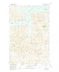
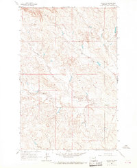
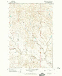
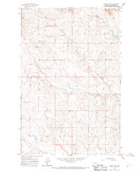
1958 Map of Maloney Hill
USGS Topo · Published 1975About this map
Fort Peck Lake and the Charles M Russell National Wildlife Range dominate this northern Montana landscape, where the Missouri River is held behind a massive dam. The terrain is defined by an intricate network of coulees and ridges, including the prominent Harper Ridge and Peterson Point, reflecting the erosion patterns typical of the Missouri Breaks. This 1958 field survey captures the area just as the Hell Creek Recreation Area was being established as a significant public access point for the reservoir.
Find a feature on this map
51 named features on this map. Tap any name to fly to it.
Don’t see what you’re looking for? This feature index may not catch every label — zoom into the map to look around manually.
Map Details
Editions of this 1958 Maloney Hill Map
2 editions found
Other maps of this area

1954 · Jordan
USGS Topo · 1:250,000

1956 · Jordan
USGS Topo · 1:250,000

1958 · Jordan
USGS Topo · 1:250,000
1958 · Collins Ranch
USGS Topo · 1:62,500
1958 · Maloney Hill
USGS Topo · 1:62,500
1958 · Seventh Point Buttes
USGS Topo · 1:24,000

1964 · Jordan
USGS Topo · 1:250,000
1964 · Jordan NE
USGS Topo · 1:24,000
1964 · Bateman Coulee
USGS Topo · 1:24,000
1964 · Jordan NW
USGS Topo · 1:24,000