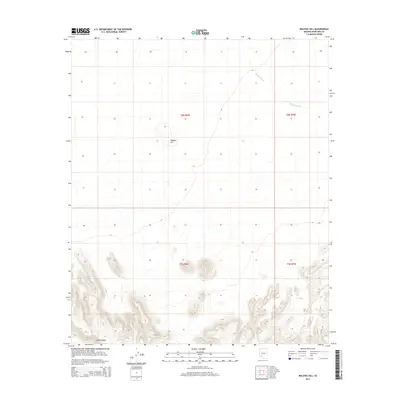
2014 Map of Malpais Hill
USGS Topo · Published 2014About this map
Malpais Hill stands as a prominent volcanic landmark within this arid section of Maricopa County. The 2014 survey captures a landscape defined by significant elevation changes, particularly in the south where the Crater Range dominates the terrain. This area is characterized by desert drainage patterns, most notably Midway Wash, which cuts across the northern townships. The grid-like Public Land Survey System divisions, including sections of t8s r8w and t9s r8w, underscore the vast, open nature of this Arizona desert territory, where human presence is marked primarily by sparse 4WD tracks and local connectors rather than established settlements.
Find a feature on this map
7 named features on this map. Tap any name to fly to it.
Don’t see what you’re looking for? This feature index may not catch every label — zoom into the map to look around manually.
Map Details
Editions of this 2014 Malpais Hill Map
This is the sole edition of this map. No revisions or reprints were ever made.
Other maps of this area

1949 · Sentinel
USGS Topo · 1:62,500

1950 · Sentinel
USGS Topo · 1:62,500

1950 · Theba
USGS Topo · 1:62,500

1951 · Theba
USGS Topo · 1:62,500

1953 · Ajo
USGS Topo · 1:250,000

1957 · Ajo
USGS Topo · 1:250,000

1958 · Ajo
USGS Topo · 1:250,000

1958 · Midway
USGS Topo · 1:62,500

1962 · Ajo
USGS Topo · 1:250,000

1963 · Ajo
USGS Topo · 1:250,000