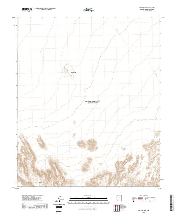
2021 Map of Malpais Hill
USGS Topo · Published 2021About this map
Malpais Hill rises from the desert floor of southern Maricopa County, serving as a prominent volcanic landmark within a sparse, arid landscape. This 2021 survey illustrates the stark topographical contrast between the broad alluvial plains and the complex, elevated terrain of the Crater Range to the south. The drainage patterns of the region are defined by ephemeral watercourses such as Midway Wash, which cuts across the northeastern portion of the quadrangle. The map serves as a clear record of the Public Land Survey System grid, detailing the intersection of T8S R8W, T8S R7W, T9S R8W, and T9S R7W. This area is characterized by its open range and significant relief, offering a precise look at the landforms that define this part of the Arizona desert near the Gila River valley.
Find a feature on this map
7 named features on this map. Tap any name to fly to it.
Don’t see what you’re looking for? This feature index may not catch every label — zoom into the map to look around manually.
Map Details
Editions of this 2021 Malpais Hill Map
This is the sole edition of this map. No revisions or reprints were ever made.
Other maps of this area

1949 · Sentinel
USGS Topo · 1:62,500

1950 · Sentinel
USGS Topo · 1:62,500

1950 · Theba
USGS Topo · 1:62,500

1951 · Theba
USGS Topo · 1:62,500

1953 · Ajo
USGS Topo · 1:250,000

1957 · Ajo
USGS Topo · 1:250,000

1958 · Ajo
USGS Topo · 1:250,000

1958 · Midway
USGS Topo · 1:62,500

1962 · Ajo
USGS Topo · 1:250,000

1963 · Ajo
USGS Topo · 1:250,000