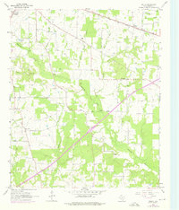
1965 Map of Malta
USGS Topo · Published 1976About this map
The Texas and Pacific railroad corridor anchors this survey of eastern Texas, cutting a path through a landscape of creek bottoms and small upland settlements. The small community of Malta is positioned directly along the rail line, while larger De Kalb sits at the northwestern edge of the sheet. The terrain is defined by a dense network of drainage, including Red Bayou and Anderson Creek, which flow toward the southern edge of the quadrangle. Local landmarks such as Austin Chapel and the small settlement of Old Salem reflect the rural social fabric of Bowie County during the mid-1960s. To the south, College Hill and Simms mark the lower reaches of the map, where the geography transitions into the open expanse of Little Prairie. This map also documents infrastructure developments, including a prominent Pipeline and Sewage Disposal Ponds, illustrating the intersection of traditional agricultural land and modern utility expansion.
Find a feature on this map
19 named features on this map. Tap any name to fly to it.
Don’t see what you’re looking for? This feature index may not catch every label — zoom into the map to look around manually.
Map Details
Editions of this 1965 Malta Map
2 editions found
Other maps of this area

1909 · New Boston
USGS Topo · 1:62,500

1930 · Bassett
USGS Topo · 1:62,500

1950 · De Kalb
USGS Topo · 1:24,000

1950 · Oak Grove
USGS Topo · 1:24,000

1951 · De Kalb
USGS Topo · 1:24,000

1951 · Oak Grove
USGS Topo · 1:24,000

1951 · Daniels Chapel
USGS Topo · 1:24,000

1953 · Texarkana
USGS Topo · 1:250,000

1954 · New Boston
USGS Topo · 1:24,000

1955 · Corley
USGS Topo · 1:24,000