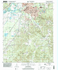
2000 Map of Malvern South
USGS Topo · Published 2002About this map
Malvern sits as the primary hub in this Hot Spring County landscape, characterized by a mix of urban street grids and the winding course of the Ouachita River. Notable infrastructure like the Malvern Municipal Airport and a prominent Drive-in Theater near Gilead Ch illustrate the local mid-century development patterns that persisted into the new millennium. The map documents an area with deep community roots, shown through numerous rural burial grounds such as Oak Ridge Cem, Manning Cem, and Ebenezer Cem. Beyond the city limits, the terrain transitions into a series of creek valleys and wooded hills, where small settlements like Perla, Harp, and Central are linked by local roads like Grigsby Ford Road. Industrial activity is evident in several Gravel Pits and a sprawling Fish Hatchery system, reflecting the diverse land use in south Arkansas.
Find a feature on this map
47 named features on this map. Tap any name to fly to it.
Don’t see what you’re looking for? This feature index may not catch every label — zoom into the map to look around manually.
Map Details
Editions of this 2000 Malvern South Map
This is the sole edition of this map. No revisions or reprints were ever made.
Other maps of this area

1948 · Malvern
USGS Topo · 1:62,500

1949 · Malvern
USGS Topo · 1:62,500

1955 · Little Rock
USGS Topo · 1:250,000

1956 · Little Rock
USGS Topo · 1:250,000

1960 · Little Rock
USGS Topo · 1:250,000

1963 · Traskwood
USGS Topo · 1:24,000

1964 · Poyen
USGS Topo · 1:24,000

1964 · Little Rock
USGS Topo · 1:250,000

1964 · Donaldson
USGS Topo · 1:24,000

1965 · Round Hill
USGS Topo · 1:24,000