
1963 Map of Traskwood
USGS Topo · Published 1964About this map
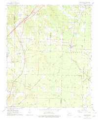
Tenmile Creek and Ninemile Creek drain a landscape shaped by early 1960s transportation and small-town infrastructure at the junction of Saline, Grant, and Hot Spring counties. The community of Glen Rose serves as a local hub, featuring several landmarks such as Glen Rose Ch and a County Library. To the east, Traskwood sits along the Chicago Rock Island and Pacific railroad, illustrating the importance of rail corridors to these rural settlements. The map documents a period of change with U.S. 67 noted as being under construction, signaling a shift in regional transit. For those researching local roots, the sheet is rich with family-named landmarks and rural institutions, including Zion Hill Ch, Fairplay Cem, and the Gifford Sch near the southern settlement of Gifford.
Find a feature on this map
47 named features on this map. Tap any name to fly to it.
Don’t see what you’re looking for? This feature index may not catch every label — zoom into the map to look around manually.
Map Details
Editions of this 1963 Traskwood Map
4 editions found
Other maps of this area

1890 · Benton
USGS Topo · 1:125,000

1894 · Benton
USGS Topo · 1:125,000

1938 · Benton
USGS Topo · 1:48,000

1944 · Benton
USGS Topo · 1:62,500

1944 · Benton
USGS Topo · 1:31,680

1948 · Malvern
USGS Topo · 1:62,500

1949 · Malvern
USGS Topo · 1:62,500

1955 · Little Rock
USGS Topo · 1:250,000

1956 · Little Rock
USGS Topo · 1:250,000

1960 · Little Rock
USGS Topo · 1:250,000