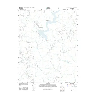
2012 Map of Mammoth Pool Dam
USGS Topo · Published 2012About this map
The San Joaquin River defines the canyon landscape of this Fresno County high country, dominated by the massive Mammoth Pool Reservoir and the Mammoth Pool Dam. This 2012 survey illustrates the recreational infrastructure established along the river's course, including Wagners Mammoth Pool Resort and numerous forest service sites like Logan Meadow Campground and China Bar Campground. The geography is shaped by high-elevation meadows and peaks, with Fuller Meadow and Summit Meadow providing open breaks in the timbered slopes. Transportation in this vertical terrain relies on Mammoth Pool Rd and Stump Springs Rd, which connect remote outposts and lookout points. Geographically isolated water features, such as Upper Horsethief Lake and Lower Horsethief Lake, sit tucked away from the main river valley, while landmarks like Mile High Curve and Jump Off Point highlight the dramatic relief of the Sierra Nevada foothills.
Find a feature on this map
44 named features on this map. Tap any name to fly to it.
Don’t see what you’re looking for? This feature index may not catch every label — zoom into the map to look around manually.
Map Details
Editions of this 2012 Mammoth Pool Dam Map
This is the sole edition of this map. No revisions or reprints were ever made.
Other maps of this area

1904 · Kaiser
USGS Topo · 1:125,000

1947 · Mariposa
USGS Topo · 1:250,000

1948 · Mariposa
USGS Topo · 1:250,000

1953 · Huntington Lake
USGS Topo · 1:62,500

1953 · Shaver Lake
USGS Topo · 1:62,500

1953 · Shuteye Peak
USGS Topo · 1:62,500

1953 · Kaiser Peak
USGS Topo · 1:62,500

1957 · Mariposa
USGS Topo · 1:250,000

1963 · Mariposa
USGS Topo · 1:250,000

1980 · Shaver Lake
USGS Topo · 1:100,000