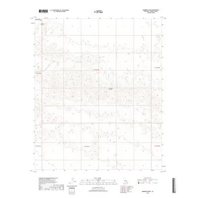
2018 Map of Mammoth Wash
USGS Topo · Published 2018About this map
The Chocolate Mountains dominate this arid landscape in Imperial County, where steep-walled drainage systems define the movement of water and terrain. The vast network of Mammoth Wash snakes through the central and western sections of the quadrangle, joined by the smaller German Diggins Wash to the north. This 2018 topographic study highlights the isolation of the range, showing an environment shaped by episodic desert flow and sharp elevation changes. To the northwest, Martinez Gulch provides a distinct break in the landforms near the boundary of the township and range survey lines. The lack of modern structures or permanent roads underscores the area's character as a preserved wilderness of the Colorado Desert, where land remains largely managed under federal jurisdiction through the Bureau of Land Management.
Find a feature on this map
11 named features on this map. Tap any name to fly to it.
Don’t see what you’re looking for? This feature index may not catch every label — zoom into the map to look around manually.
Map Details
Editions of this 2018 Mammoth Wash Map
This is the sole edition of this map. No revisions or reprints were ever made.
Other maps of this area

1940 · Iris
USGS Topo · 1:62,500

1940 · Iris Pass
USGS Topo · 1:62,500

1945 · Iris Pass
USGS Topo · 1:62,500

1945 · Iris
USGS Topo · 1:62,500

1953 · Acolita
USGS Topo · 1:24,000

1953 · Chuckwalla Spring
USGS Topo · 1:62,500

1953 · Acolita
USGS Topo · 1:62,500

1954 · Salton Sea
USGS Topo · 1:250,000

1955 · Tortuga
USGS Topo · 1:24,000

1955 · Salton Sea
USGS Topo · 1:250,000