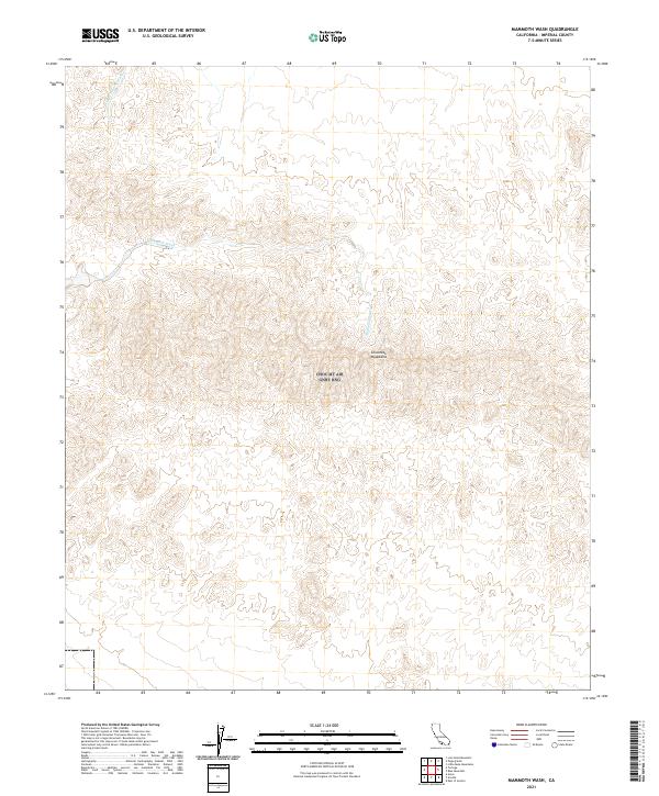
2021 Map of Mammoth Wash
USGS Topo · Published 2021About this map
The Chocolate Mountains dominate this 2021 landscape in Imperial County, defining a topography of complex ridges and drainage systems. This interior desert region is characterized by significant ephemeral watercourses, most notably the broad Mammoth Wash which bisects the central terrain. Further north, German Diggins Wash carves through the elevation, its name alluding to the historical prospecting and mining activity common to this part of the California desert. The map provides a precise look at the township and range survey lines, including t11s r17e and t12s r17e, which overlay a territory largely devoid of modern settlements or developed infrastructure, highlighting the preservation of this arid mountain environment.
Find a feature on this map
10 named features on this map. Tap any name to fly to it.
Don’t see what you’re looking for? This feature index may not catch every label — zoom into the map to look around manually.
Map Details
Editions of this 2021 Mammoth Wash Map
This is the sole edition of this map. No revisions or reprints were ever made.
Other maps of this area

1940 · Iris
USGS Topo · 1:62,500

1940 · Iris Pass
USGS Topo · 1:62,500

1945 · Iris Pass
USGS Topo · 1:62,500

1945 · Iris
USGS Topo · 1:62,500

1953 · Acolita
USGS Topo · 1:24,000

1953 · Chuckwalla Spring
USGS Topo · 1:62,500

1953 · Acolita
USGS Topo · 1:62,500

1954 · Salton Sea
USGS Topo · 1:250,000

1955 · Tortuga
USGS Topo · 1:24,000

1955 · Salton Sea
USGS Topo · 1:250,000