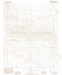
1988 Map of Mammoth Wash
USGS Topo · Published 1988About this map
Chocolate Mountains dominate this 1980s landscape, illustrating a restricted desert environment defined by military use and natural drainage patterns. The southern half of the map is marked by the Aerial Gunnery Range, a designation that fundamentally limited civilian development and preserved the arid terrain in its mid-century state. Braided watercourses such as German Diggins Wash and Mammoth Wash cut through the alluvial fans, providing the primary geographical structure for the area. Aside from a few 4wd tracks, the map reveals a notable absence of permanent infrastructure, highlighting the region's role as a specialized military training ground. This survey captures the intersection of natural desert topography and the administrative boundaries of Southern California's defense-related land management during the late twentieth century.
Find a feature on this map
9 named features on this map. Tap any name to fly to it.
Don’t see what you’re looking for? This feature index may not catch every label — zoom into the map to look around manually.
Map Details
Editions of this 1988 Mammoth Wash Map
This is the sole edition of this map. No revisions or reprints were ever made.
Other maps of this area

1940 · Iris
USGS Topo · 1:62,500

1940 · Iris Pass
USGS Topo · 1:62,500

1945 · Iris Pass
USGS Topo · 1:62,500

1945 · Iris
USGS Topo · 1:62,500

1953 · Acolita
USGS Topo · 1:24,000

1953 · Chuckwalla Spring
USGS Topo · 1:62,500

1953 · Acolita
USGS Topo · 1:62,500

1954 · Salton Sea
USGS Topo · 1:250,000

1955 · Tortuga
USGS Topo · 1:24,000

1955 · Salton Sea
USGS Topo · 1:250,000