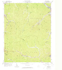
1963 Map of Man
USGS Topo · Published 1974About this map
The Guyandotte River cuts through the northern reach of this landscape, anchoring the settlement of Man and the residential stretch of Hensley Heights. This mid-century survey documents a region defined by narrow valley communities and the coal economy, with the Chesapeake and Ohio railroad following the river and several creek beds to serve sites like the Tippie Mine and its associated Mine Dump. To the south, the terrain becomes increasingly steep as it crosses from Logan into Mingo County, where family history is etched into the land at the Hatfield Cem and Smith Cem. Smaller settlements such as Sarah Ann, Crystal Block, and Sharon Heights occupy the limited level ground along Island Creek and Horsepen Creek, while the Mingo Lookout Tower on Horsepen Mtn provides a clear vantage point over the dense network of hollows.
Find a feature on this map
71 named features on this map. Tap any name to fly to it.
Don’t see what you’re looking for? This feature index may not catch every label — zoom into the map to look around manually.
Map Details
Editions of this 1963 Man Map
3 editions found
Other maps of this area

1887 · Warfield
USGS Topo · 1:125,000

1891 · Oceana
USGS Topo · 1:125,000

1891 · Warfield
USGS Topo · 1:125,000

1893 · Oceana
USGS Topo · 1:125,000

1898 · Oceana
USGS Topo · 1:125,000

1909 · Matewan
USGS Topo · 1:48,000

1909 · Gilbert
USGS Topo · 1:48,000

1910 · Holden
USGS Topo · 1:48,000

1912 · Gilbert
USGS Topo · 1:62,500

1912 · Holden
USGS Topo · 1:62,500