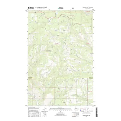
2017 Map of Manastash Lake
USGS Topo · Published 2017About this map
Manastash Lake sits at the northern edge of this high-elevation landscape, where the boundaries of the Wenatchee National Forest and Snoqualmie National Forest meet. The terrain is defined by a complex network of seasonal water sources and primitive forest roads, including Hog Ranch Rd and the Manastash Bypass. Evidence of historical land use is found in labels like Cattle Camp Spring and Dipping Vat Canyon, suggesting a legacy of seasonal grazing and livestock management in these upland areas. To the south, the terrain descends toward the Naches River, passing through significant geological features such as Cleman Mtn and the broad opening of Rocky Prairie. This 2017 survey details a region managed for both timber and recreation, preserved here through its specific 4WD trail designations and forest development routes.
Find a feature on this map
57 named features on this map. Tap any name to fly to it.
Don’t see what you’re looking for? This feature index may not catch every label — zoom into the map to look around manually.
Map Details
Editions of this 2017 Manastash Lake Map
This is the sole edition of this map. No revisions or reprints were ever made.
Other maps of this area

1897 · Mount Stuart
USGS Topo · 1:125,000

1899 · Ellensburg
USGS Topo · 1:125,000

1901 · Ellensburg
USGS Topo · 1:125,000

1901 · Snoqualmie Pass
USGS Topo · 1:125,000

1902 · Mount Aix
USGS Topo · 1:125,000

1902 · Mount Stuart
USGS Topo · 1:125,000

1903 · Snoqualmie
USGS Topo · 1:125,000

1904 · Mt Aix
USGS Topo · 1:125,000

1950 · Yakima
USGS Topo · 1:250,000

1957 · Wenatchee
USGS Topo · 1:250,000