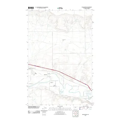
2011 Map of Manchester
USGS Topo · Published 2011About this map
The Sun River snakes through the southern reaches of this landscape, its path marked by meanders and the prominent Horseshoe Lake. The residential communities of Sun Prairie and Manchester anchor the central-west region, showcasing the mid-century to modern expansion of the area. Public infrastructure is well-defined, including the Vaughn Vol Fire Dept Manchester Sta and the Sunset Memorial Gardens cemetery south of the main settlement. The northern territory is dominated by irrigation and drainage features like the Manchester Lateral and the Payton Place Dam, illustrating the managed water system required for local agricultural or industrial needs. Numerous named rural roads, such as Stuckey Rd and McIver Rd, provide a detailed network for genealogists tracing local property boundaries or family homesites.
Find a feature on this map
28 named features on this map. Tap any name to fly to it.
Don’t see what you’re looking for? This feature index may not catch every label — zoom into the map to look around manually.
Map Details
Editions of this 2011 Manchester Map
This is the sole edition of this map. No revisions or reprints were ever made.
Other maps of this area

1886 · Great Falls
USGS Topo · 1:250,000

1949 · Cascade
USGS Topo · 1:62,500

1949 · Great Falls
USGS Topo · 1:62,500

1949 · Vaughn
USGS Topo · 1:62,500

1951 · Great Falls
USGS Topo · 1:62,500

1951 · Cascade
USGS Topo · 1:62,500

1952 · Vaughn
USGS Topo · 1:62,500

1954 · Great Falls
USGS Topo · 1:250,000

1955 · Gore Hill
USGS Topo · 1:62,500

1957 · Great Falls
USGS Topo · 1:250,000