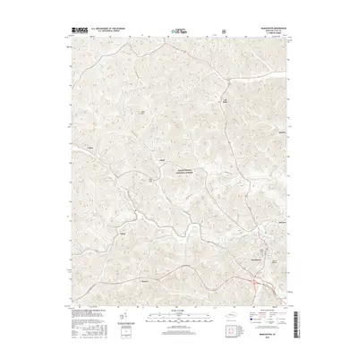
2016 Map of Manchester
USGS Topo · Published 2016About this map
The city of Manchester serves as the focal point of this Eastern Kentucky landscape, situated where the Hal Rogers Pky cuts through the narrow valleys of Clay County. The terrain is defined by a dense network of ridges and hollows, including Tanard Hollow and high points like Pilot Mtn. Large portions of the northwestern and central territory are protected within the Daniel Boone National Forest, creating a mosaic of public and private land.
Find a feature on this map
20 named features on this map. Tap any name to fly to it.
Don’t see what you’re looking for? This feature index may not catch every label — zoom into the map to look around manually.
Map Details
Editions of this 2016 Manchester Map
This is the sole edition of this map. No revisions or reprints were ever made.
Other maps of this area

1891 · Manchester
USGS Topo · 1:125,000

1952 · Portersburg
USGS Topo · 1:24,000

1952 · Hima
USGS Topo · 1:24,000

1952 · Blackwater
USGS Topo · 1:24,000

1952 · Manchester
USGS Topo · 1:24,000

1953 · Oneida
USGS Topo · 1:24,000

1953 · Tyner
USGS Topo · 1:24,000

1954 · Barcreek
USGS Topo · 1:24,000

1954 · Maulden
USGS Topo · 1:24,000
1954 · Ogle
USGS Topo · 1:24,000