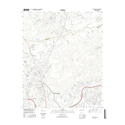
2016 Map of Manchester
USGS Topo · Published 2016About this map
The Little River and the northern outskirts of Fayetteville define this 2016 survey of Cumberland and Harnett Counties. The map captures a high density of military and institutional landmarks, including the Pope AFB Site #1 and Simmons Army Airfield, reflecting the area's deep ties to the adjacent military installation. Genealogists and local historians will find significant value in the documentation of the Sandhills State Veterans Cem and the Fort Bragg Main Post Cemetary, situated near the residential corridors of Manchester. The landscape is characterized by a complex hydraulic network of small lakes and ponds, such as Twin Lakes, Lake Holton, and Simmons Lake, which are integrated into the rolling topography. Further south, the campus of Methodist University sits near Cross Creek, marking the transition into more developed urban areas.
Find a feature on this map
231 named features on this map. Tap any name to fly to it.
Don’t see what you’re looking for? This feature index may not catch every label — zoom into the map to look around manually.
Map Details
Editions of this 2016 Manchester Map
This is the sole edition of this map. No revisions or reprints were ever made.
Other maps of this area

1948 · Fayetteville
USGS Topo · 1:62,500

1948 · Clifdale
USGS Topo · 1:62,500

1948 · Slocomb
USGS Topo · 1:24,000

1948 · Clifdale
USGS Topo · 1:24,000

1949 · Vander
USGS Topo · 1:24,000

1950 · Clifdale
USGS Topo · 1:24,000

1950 · Fayetteville
USGS Topo · 1:24,000

1950 · Manchester
USGS Topo · 1:24,000

1950 · Slocomb
USGS Topo · 1:24,000

1951 · Clifdale
USGS Topo · 1:62,500