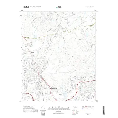
2019 Map of Manchester
USGS Topo · Published 2019About this map
Simmons Army Airfield and the northern outskirts of Fayetteville anchor this 2019 view of the Cumberland and Harnett County border. The landscape is defined by its military and civic infrastructure, most notably the Sandhills State Veterans Cem and Fort Bragg Main Post Cemetery, which serve as significant landmarks for genealogists and local historians. To the north, the settlement of Manchester sits near the winding course of the Little River, while the growing community of Spring Lake occupies the central portion of the map.
Find a feature on this map
213 named features on this map. Tap any name to fly to it.
Don’t see what you’re looking for? This feature index may not catch every label — zoom into the map to look around manually.
Map Details
Editions of this 2019 Manchester Map
This is the sole edition of this map. No revisions or reprints were ever made.
Other maps of this area

1948 · Fayetteville
USGS Topo · 1:62,500

1948 · Clifdale
USGS Topo · 1:62,500

1948 · Slocomb
USGS Topo · 1:24,000

1948 · Clifdale
USGS Topo · 1:24,000

1949 · Vander
USGS Topo · 1:24,000

1950 · Clifdale
USGS Topo · 1:24,000

1950 · Fayetteville
USGS Topo · 1:24,000

1950 · Manchester
USGS Topo · 1:24,000

1950 · Slocomb
USGS Topo · 1:24,000

1951 · Clifdale
USGS Topo · 1:62,500