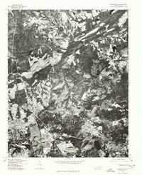
1976 Map of Manchester
USGS Topo · Published 1978About this map
Fort Bragg military infrastructure dominates the landscape of this 1970s orthophotograph, showcasing the significant federal footprint in Cumberland County. The imagery, rectified from 1976 aerial photography, reveals the high-density residential and operational layout of the post alongside more rural patterns. To the northwest, the settlement of Manchester sits near the winding corridors of the Little River and its surrounding wooded terrain. The transition from the developed military installation to the dispersed residential pockets around Twin Lakes highlights the dual nature of this region as both a strategic defense hub and a growing residential area during the mid-1970s. This specific survey serves as a visual record of the land use patterns before the further expansion of the Fayetteville area.
Find a feature on this map
3 named features on this map. Tap any name to fly to it.
Don’t see what you’re looking for? This feature index may not catch every label — zoom into the map to look around manually.
Map Details
Editions of this 1976 Manchester Map
This is the sole edition of this map. No revisions or reprints were ever made.
Other maps of this area

1948 · Fayetteville
USGS Topo · 1:62,500

1948 · Clifdale
USGS Topo · 1:62,500

1948 · Slocomb
USGS Topo · 1:24,000

1948 · Clifdale
USGS Topo · 1:24,000

1949 · Vander
USGS Topo · 1:24,000

1950 · Clifdale
USGS Topo · 1:24,000

1950 · Fayetteville
USGS Topo · 1:24,000

1950 · Manchester
USGS Topo · 1:24,000

1950 · Slocomb
USGS Topo · 1:24,000

1951 · Clifdale
USGS Topo · 1:62,500