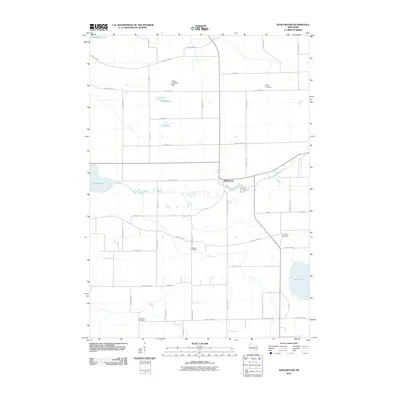
2010 Map of Manchester
USGS Topo · Published 2010About this map
The Grand River and Fox River meander through this rural Green Lake County landscape, anchoring the small settlement of Manchester. This area is defined by its numerous small basins and glacial features, including Puckaway Lake in the northwest and the larger Lake Maria to the southeast. For genealogists, the map identifies several distinct burial grounds scattered across the townships, such as Phelps Cemetery, Williams Cemetery, and the Krastetter Cemetery near the southern border. The transition between water and land is further marked by several small, isolated water bodies like Heart Lake and Dog Lake. Local infrastructure is represented by a grid of county highways and the Hilltop Landing Strip, illustrating the agricultural and small-town character of central Wisconsin during the early twenty-first century.
Find a feature on this map
49 named features on this map. Tap any name to fly to it.
Don’t see what you’re looking for? This feature index may not catch every label — zoom into the map to look around manually.
Map Details
Editions of this 2010 Manchester Map
This is the sole edition of this map. No revisions or reprints were ever made.
Other maps of this area

1915 · Neshkoro
USGS Topo · 1:48,000

1916 · Ripon
USGS Topo · 1:48,000

1918 · Neshkoro
USGS Topo · 1:62,500

1918 · Ripon
USGS Topo · 1:62,500

1955 · Randolph
USGS Topo · 1:62,500

1955 · Fox Lake
USGS Topo · 1:62,500

1956 · Ripon
USGS Topo · 1:62,500

1957 · Madison
USGS Topo · 1:250,000

1960 · Madison
USGS Topo · 1:250,000

1963 · Neshkoro
USGS Topo · 1:62,500