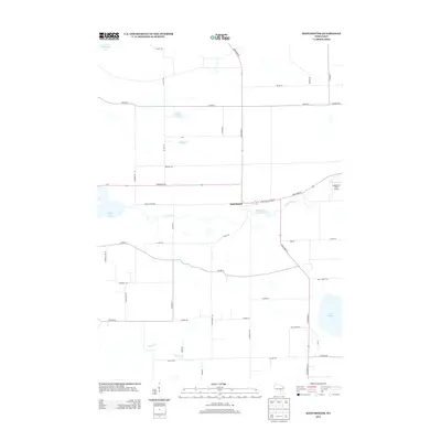
2013 Map of Manchester
USGS Topo · Published 2013About this map
Manchester serves as the central hub of this Green Lake County landscape, situated at the intersection of State Road 44 and State Road 73. The geography is defined by a dense network of water bodies, including the Grand River and the Fox River, which traverse the agricultural terrain. A notable historical marker on the map is the Mill Pond (historical) located just east of the main settlement, signaling a legacy of water-powered industry in the area. The surrounding countryside is dotted with smaller lakes such as Heart Lake, Dog Lake, and Lake Maria, while Puckaway Lake and Grand Lake anchor the western edge. Aviation is represented on the eastern periphery by Nowatzki Field Airport, contrasting with the numerous family-named rural roads like Phelps Rd and Luedtke Rd that delineate the local property divisions.
Find a feature on this map
48 named features on this map. Tap any name to fly to it.
Don’t see what you’re looking for? This feature index may not catch every label — zoom into the map to look around manually.
Map Details
Editions of this 2013 Manchester Map
This is the sole edition of this map. No revisions or reprints were ever made.
Other maps of this area

1915 · Neshkoro
USGS Topo · 1:48,000

1916 · Ripon
USGS Topo · 1:48,000

1918 · Neshkoro
USGS Topo · 1:62,500

1918 · Ripon
USGS Topo · 1:62,500

1955 · Randolph
USGS Topo · 1:62,500

1955 · Fox Lake
USGS Topo · 1:62,500

1956 · Ripon
USGS Topo · 1:62,500

1957 · Madison
USGS Topo · 1:250,000

1960 · Madison
USGS Topo · 1:250,000

1963 · Neshkoro
USGS Topo · 1:62,500