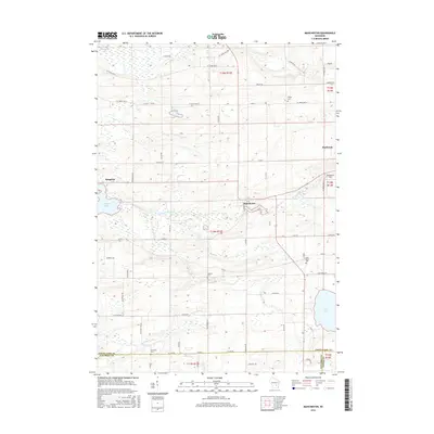
2016 Map of Manchester
USGS Topo · Published 2016About this map
The Grand River and Fox River systems define the drainage of this central Wisconsin landscape, where several large water bodies such as Puckaway Lake and Lake Maria are prominent features. This 2016 survey shows the agricultural character of Green Lake County, anchored by the settlements of Manchester, Kingston, and the edge of Markesan. For genealogists and local historians, the sheet identifies several resting places including Phelps Cem, Williams Cem, Lake Maria Cem, and Krastetter Cem. The terrain is characterized by numerous small lakes and marshy areas, such as Heart Lake and Dog Lake, which connect to the larger river networks. Landmarks like Nowatzki Field and a grid of well-defined county trunk highways reflect the modern rural infrastructure and land use in this part of the state.
Find a feature on this map
68 named features on this map. Tap any name to fly to it.
Don’t see what you’re looking for? This feature index may not catch every label — zoom into the map to look around manually.
Map Details
Editions of this 2016 Manchester Map
This is the sole edition of this map. No revisions or reprints were ever made.
Other maps of this area

1915 · Neshkoro
USGS Topo · 1:48,000

1916 · Ripon
USGS Topo · 1:48,000

1918 · Neshkoro
USGS Topo · 1:62,500

1918 · Ripon
USGS Topo · 1:62,500

1955 · Randolph
USGS Topo · 1:62,500

1955 · Fox Lake
USGS Topo · 1:62,500

1956 · Ripon
USGS Topo · 1:62,500

1957 · Madison
USGS Topo · 1:250,000

1960 · Madison
USGS Topo · 1:250,000

1963 · Neshkoro
USGS Topo · 1:62,500