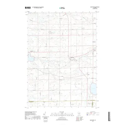
2018 Map of Manchester
USGS Topo · Published 2018About this map
The Grand River snakes through the heart of this landscape, connecting the village of Manchester with Grand Lake to the west. This agricultural region of southern Wisconsin is defined by its water systems, from the Fox River in the south to the expansive Lake Maria on the eastern edge. Small-town centers like Kingston and Markesan serve as local anchors, while the countryside is dotted with small burial grounds such as Phelps Cem, Williams Cem, and Krastetter Cem. The terrain is shaped by glacial remnants, visible in the numerous small water bodies like Heart Lake and Dog Lake. Local transport is dictated by a grid of county highways and named rural routes including Lovers Ln and Zink Rd, reflecting the late-20th-century development of the Green Lake and Columbia County borderlands.
Find a feature on this map
55 named features on this map. Tap any name to fly to it.
Don’t see what you’re looking for? This feature index may not catch every label — zoom into the map to look around manually.
Map Details
Editions of this 2018 Manchester Map
This is the sole edition of this map. No revisions or reprints were ever made.
Other maps of this area

1915 · Neshkoro
USGS Topo · 1:48,000

1916 · Ripon
USGS Topo · 1:48,000

1918 · Neshkoro
USGS Topo · 1:62,500

1918 · Ripon
USGS Topo · 1:62,500

1955 · Randolph
USGS Topo · 1:62,500

1955 · Fox Lake
USGS Topo · 1:62,500

1956 · Ripon
USGS Topo · 1:62,500

1957 · Madison
USGS Topo · 1:250,000

1960 · Madison
USGS Topo · 1:250,000

1963 · Neshkoro
USGS Topo · 1:62,500